
60 years has made a big difference in the urban form of American cities. This visual tool is a way to review the scope of these changes. In many cases, the most notable changes are a legacy of the urban renewal programs and planning of the mid-century period. This often meant the clearance of large swaths of developed urban land, especially downtown districts and Black, immigrant, or low-income areas and replacement with freeways, institutions, and mega-projects. For additional context and readings, visit the project homepage.
We put together these sliders to show how cities have changed over half a century.
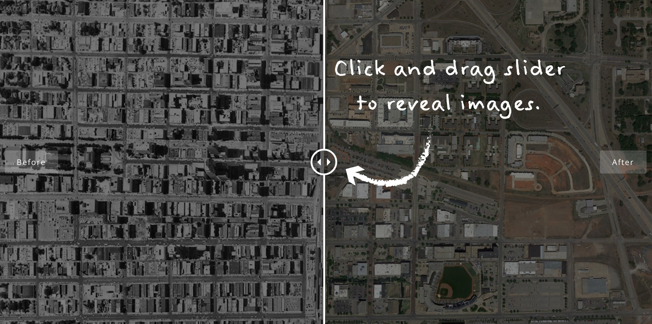
How to Use
Click and drag the slider as shown in the image below to compare images.
Cincinnati, 1955 to 2013
The images of Cincinnati show incredible destruction of dense urban neighborhoods to the west and south of downtown caused by the construction of interstate highways. One of the worst impacted areas is the West End or “Kenyon-Barr,” which was a mostly Black neighborhood of 25,000 people in the 1950s and is not populated today. The riverfront area was cut off from the downtown by a section of I-71 known as Fort Washington Way, but redevelopment has followed successful planning efforts there. In the future, the freeway could be capped to provide better connections to downtown.
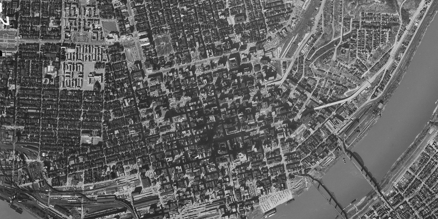

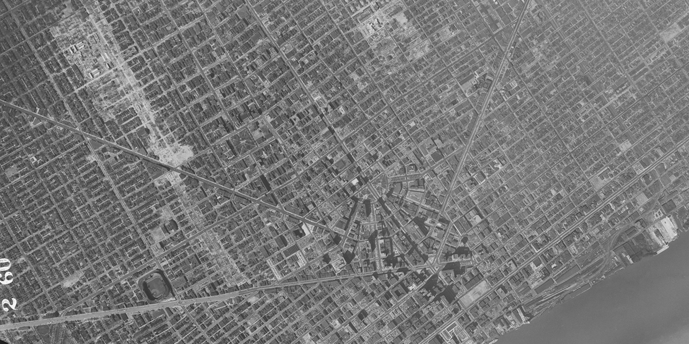
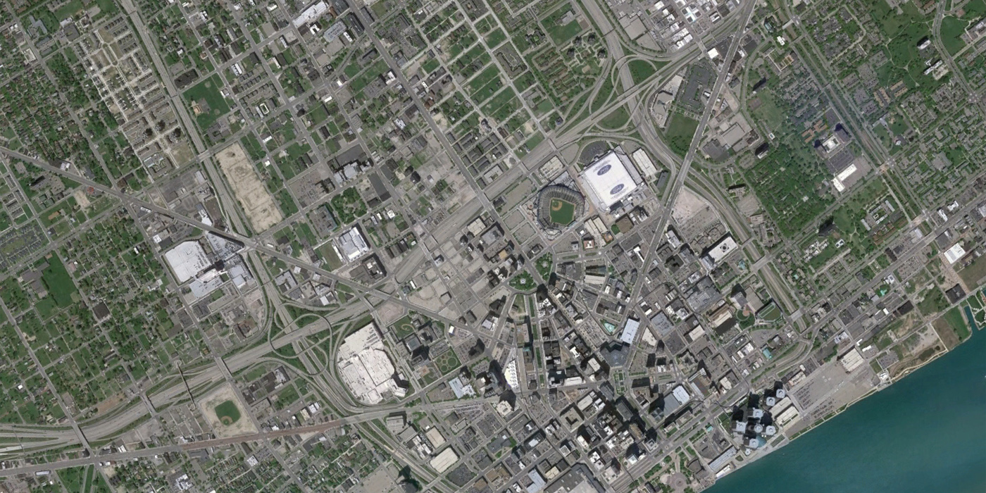
Detroit, 1951 to 2010
Much of Detroit is unrecognizable between the 1951 and 2010 aerial views. The iconic radial corridors extending from Campus Martius- Woodward, Gratiot, and Michigan, are among the few things that have stayed the same. In 1951, you can see vast swaths of the city beginning to be cleared for highway spurs and large-scale redevelopments. By 2010, downtown is encircled by highways. A noticeable positive change is the transformation of a confusing intersection at the heart of Detroit into Campus Martius Park, which opened in 2004.
[Update: Michigan Public Radio has provided additional comments on this image.]
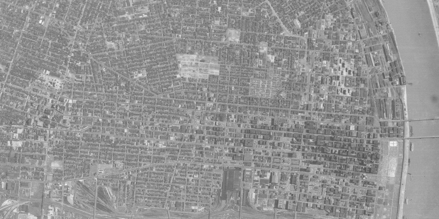
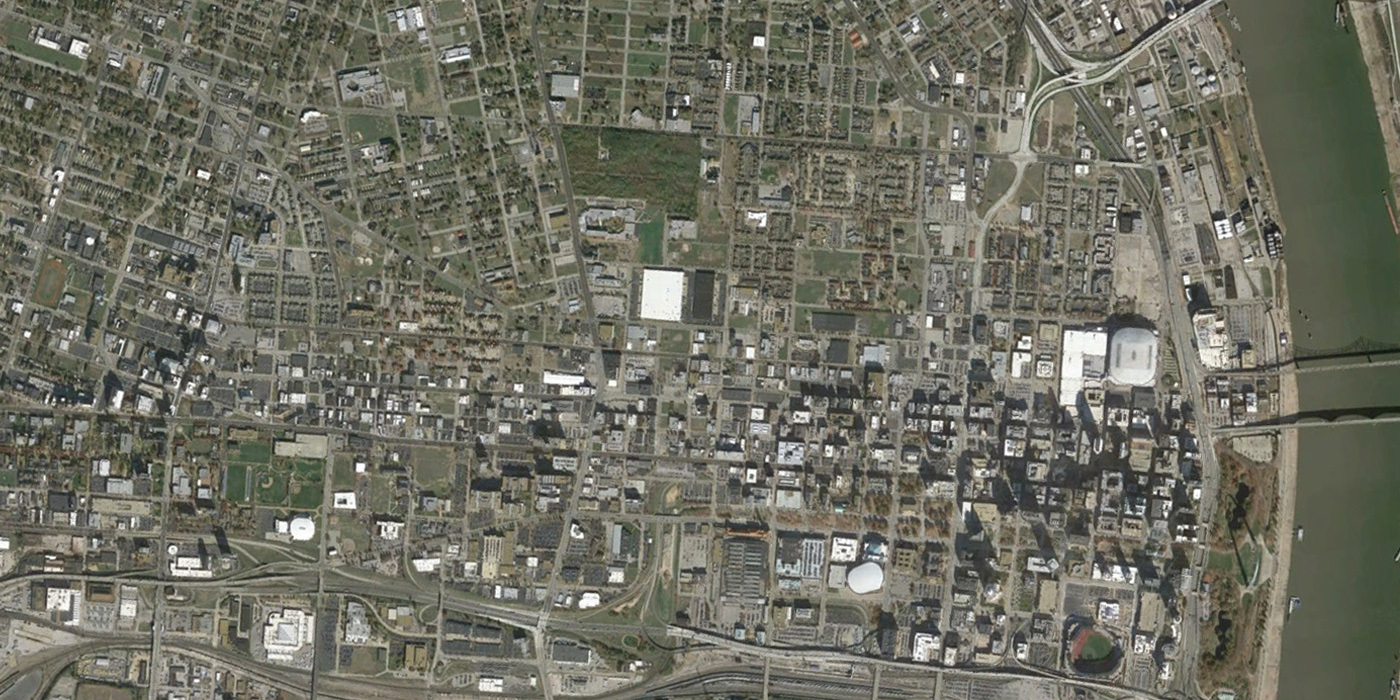
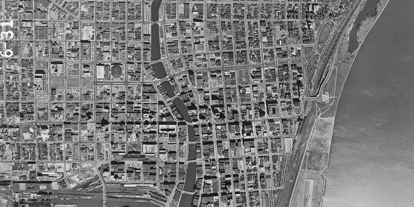
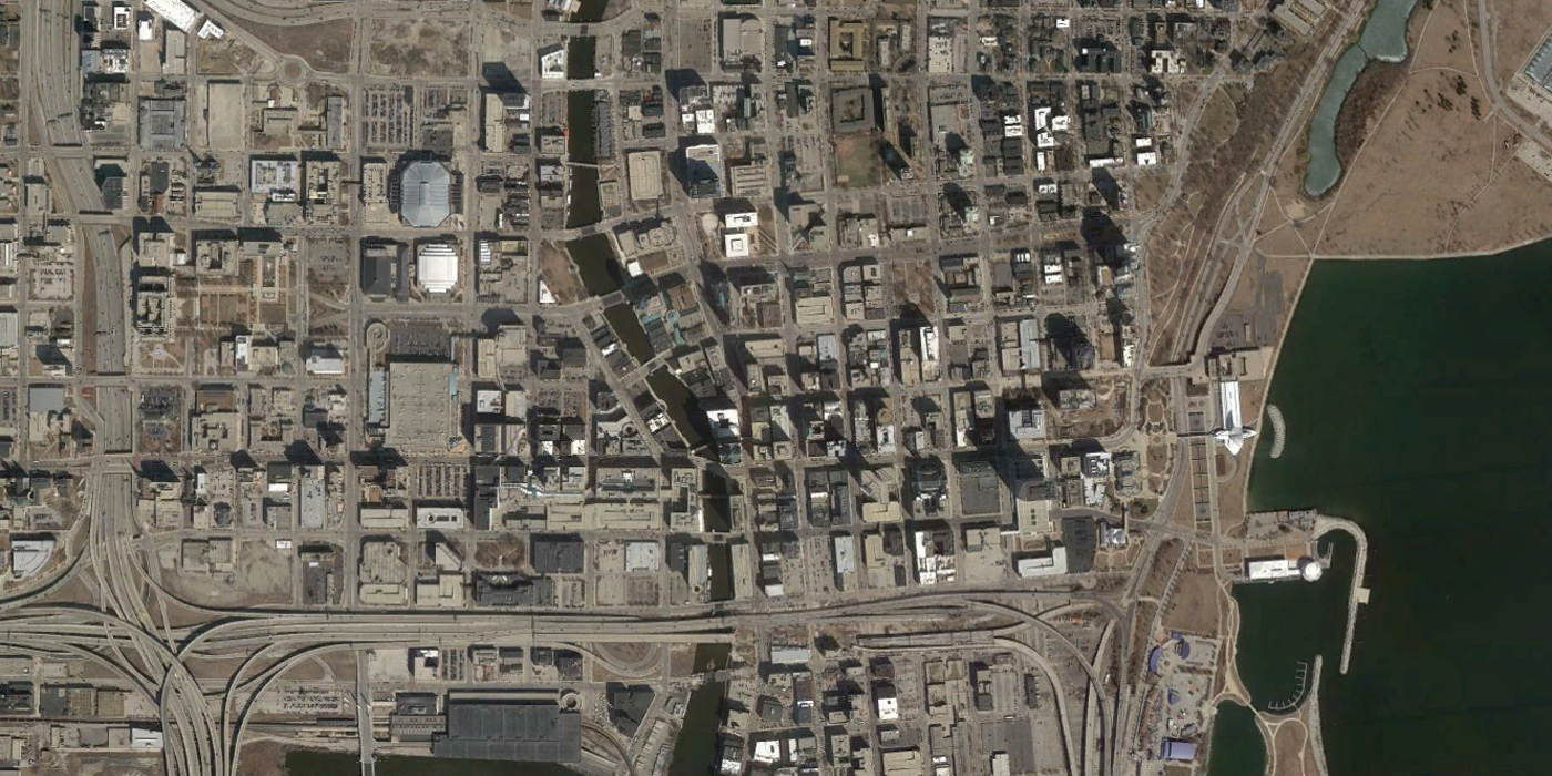
St. Louis, 1952 to 2013
In the 1952 St. Louis aerial, the clearance site for the Gateway Arch and surrouning grounds is clearly visibile on the riverfront. Toward the northeast, another large clearance site will be the location of Pruitt-Igoe, the notorious failed public housing development. In the modern aerial, the striking number of vacant lots in north St. Louis is apparent. Many neighborhoods targeted for urban renewal in St. Louis were African American areas like Mill Creek, where 20,000 Black residents were displaced, or immigrant neighborhoods like Kosciusko.
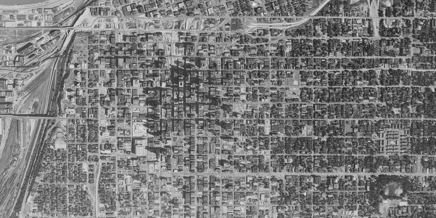
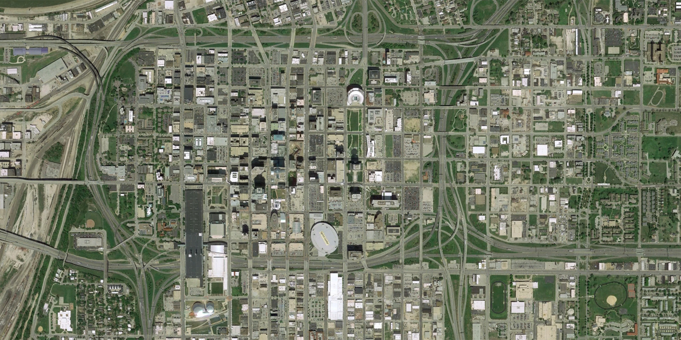
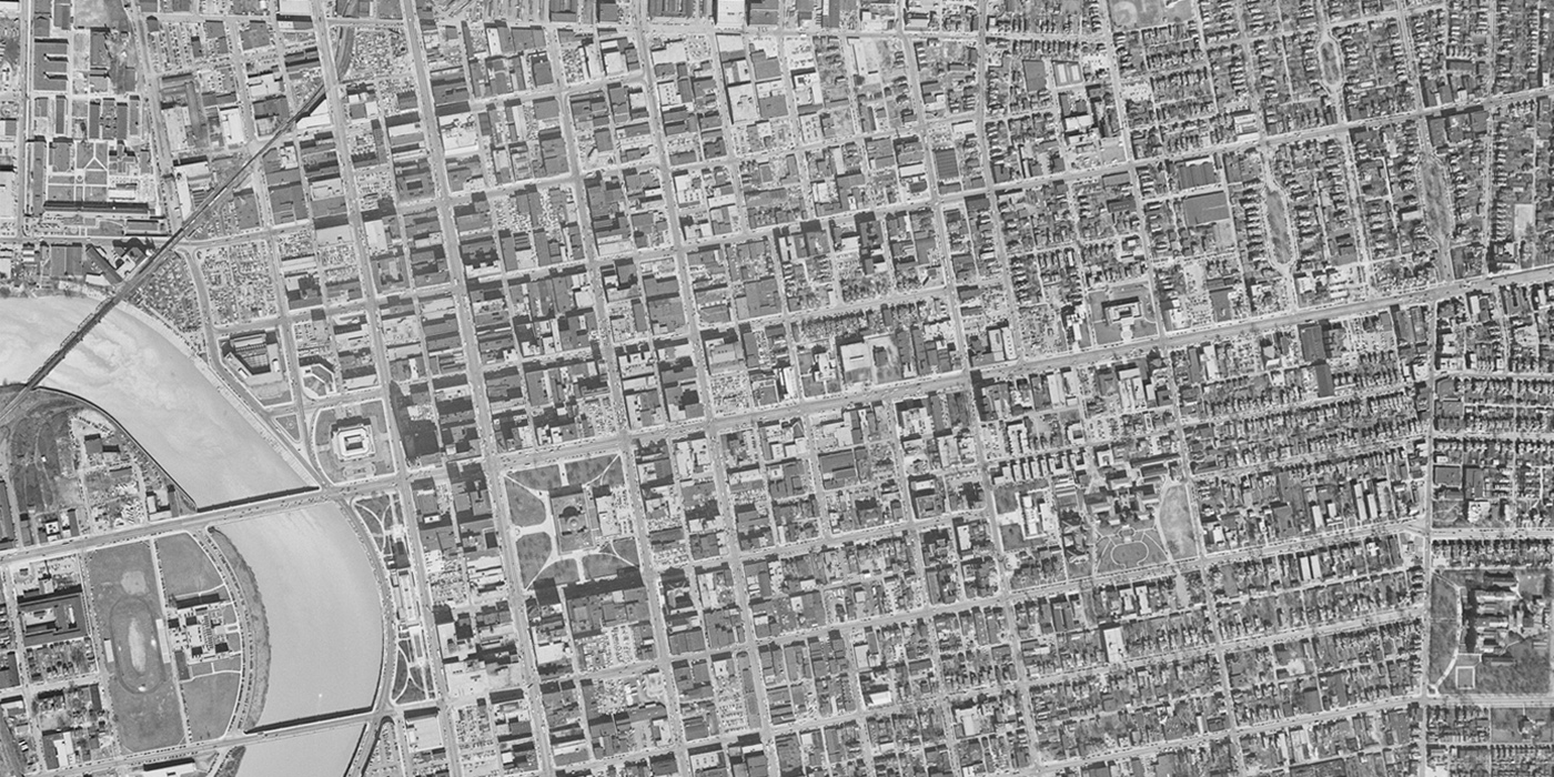
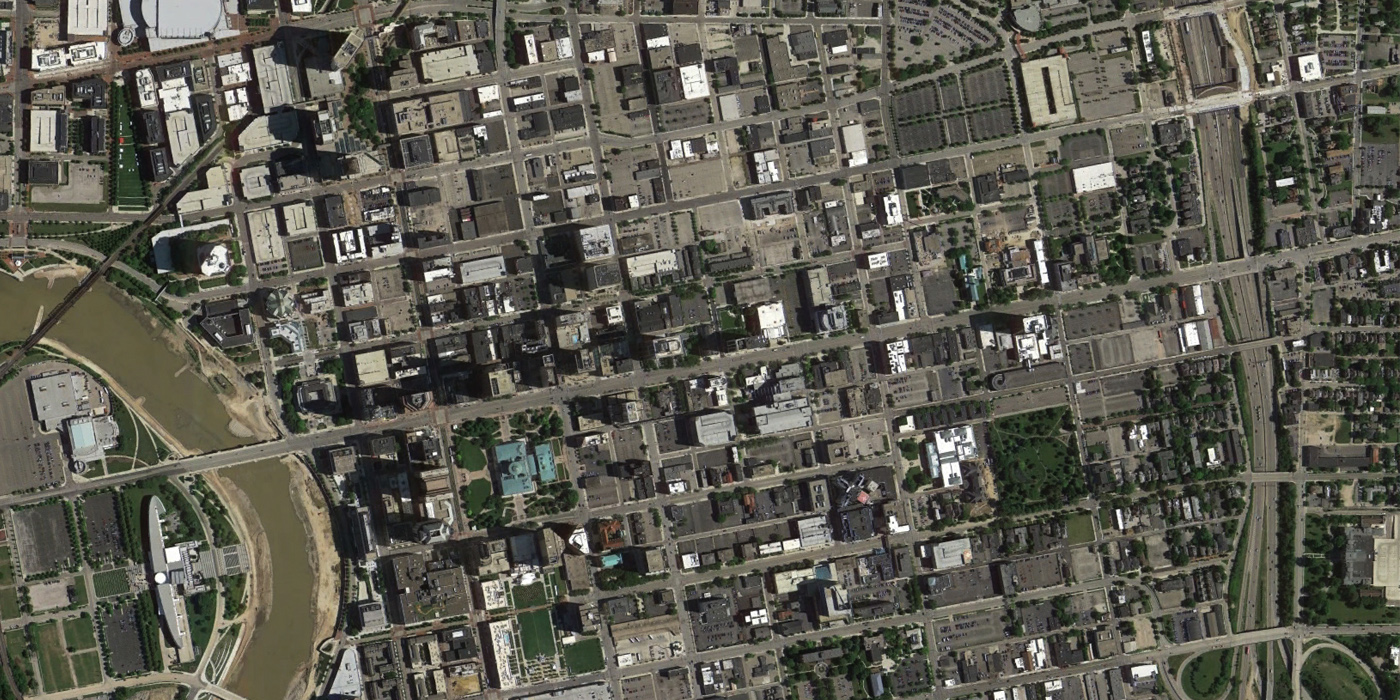
Kansas City, 1955 to 2014
The clearance and construction for what will become a ring of freeways around Kansas City has already begun in the 1955 aerial image. An excellent overview of freeway-building and urban renewal in Kansas City is available at Strong Towns.
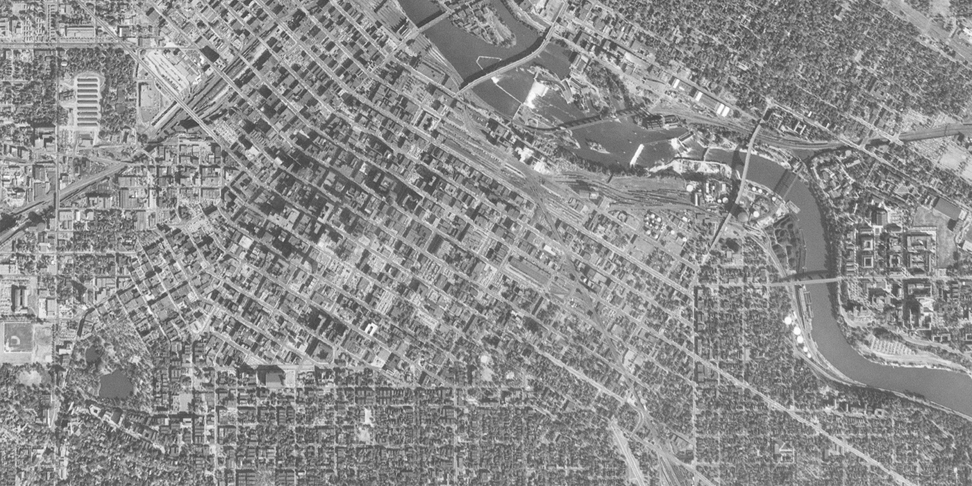
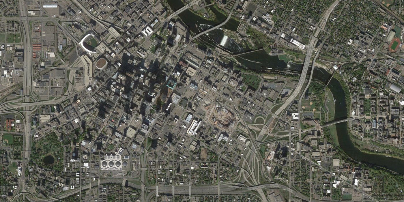
Minneapolis, 1953 to 2014
Downtown Minneapolis was also encircled by interstate highways at the expense of dense urban neighborhoods. Downtown East has become the home of an NFL stadium and a significant development called The Yard is planned there.
Milwaukee, 1955 to 2014
Milwaukee sees significant demolition throughout the downtown. However, some efforts have been made to restore the old street patterns. Along the top of the image, the site of the Park East Freeway removal and boulevard replacement has returned land for possible development.
Indianapolis, 1958 to 2014
In Indianapolis, large surface parking lots and institutional uses have replaced many blocks of neighborhoods, and the city’s successful sports and convention area has grown up in the south. Invisible Indianapolis is an excellent resource on the history of ‘invisible’ neighborhoods in the city, including an article on how the IUPUI campus took over the near-Westside area.
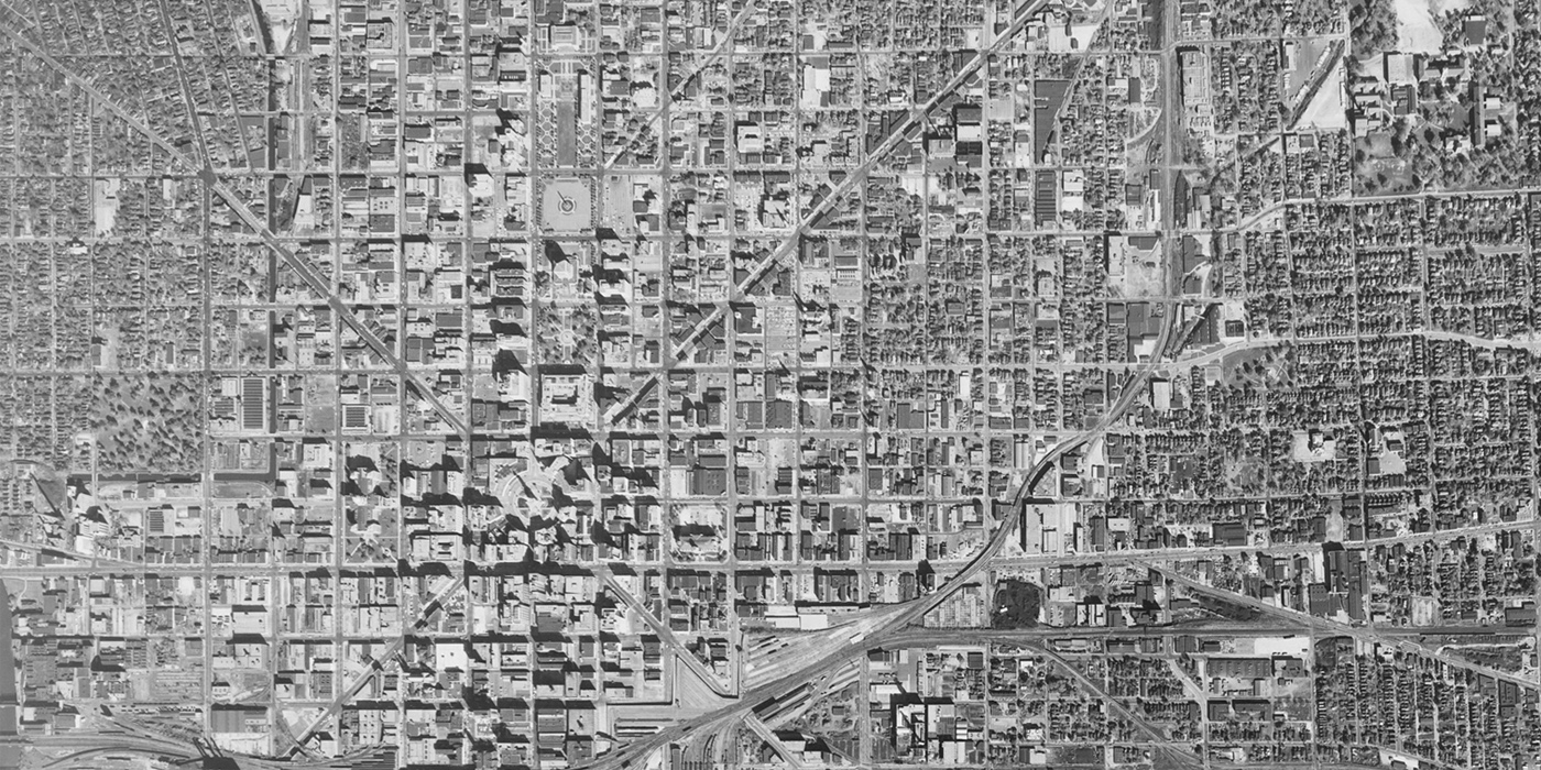
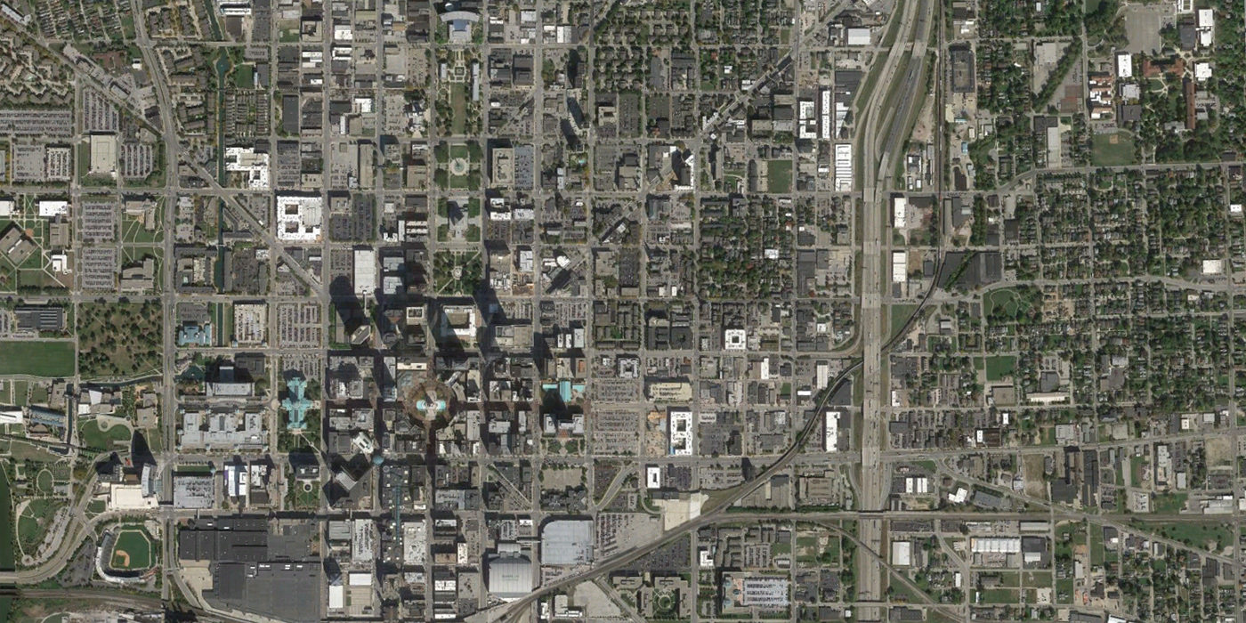
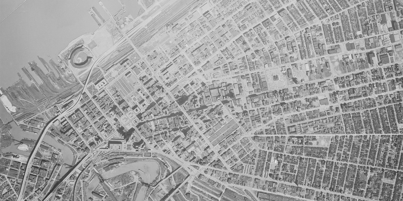
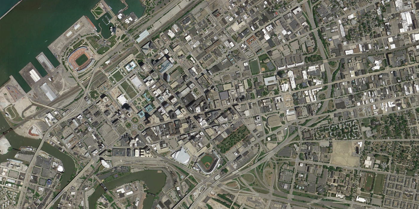
Cleveland, 1952 to 2014
Cleveland’s iconic Public Square has remained since the city’s original plan and The Mall, part of an early 1900s Daniel Burnham plan, continues as an important civic center. Some of the largest urban renewal impacts in this image include the Erieview area which was cleared for an IM Pei urban renewal plan and several freeways. An article here provides additional context and aerial images of other neighborhoods impacted by freeways. Despite losing several blocks of urban fabric, the Warehouse District has evolved into a successful mixed-use area, and the well-preserved area around East Fourth has also become an important district for Cleveland dining and entertainment.
Columbus, 1953 to 2014
Central Columbus is now dotted with surface parking lots and surrounded by freeways. However, the fact that some of the highways are constructed in trenches has allowed interesting solutions like the Cap at Union Station to repair connections to neighborhoods.
SAD
Wow. Eye opening.
Look carefully. Almost none of these pictures show the exact same area.
Bill – Are you joking? Registration is even pretty good on all of them.
Yeah, I was thinking how well-aligned they are. It’s rare to get such a good match on old photos. I give them a lot of credit.
I think Bill might not have noticed the slider bar and thought it was just a left-right comparison.
Thanks for pointing out the slide bar! I was thinking the same thing as Bill, but now I see how the slide bar operates. Thanks!
Agreed, Bill- Milwaukee, Cincinatti, Columbus, Detroit, Cleveland and Minneapolis don’t line up at all. It’s a shame because there’s an interesting story to be told, but the pictures don’t compare lie-for-like.
…and then your search engine kicks into life and you’re able to move the slider over and see that actually the registration IS near perfect and this a great set of pictures. my apologies.
Opvallend dat er zo veel meer ruimte is gemaakt voor infrastructuur ten koste van de woonfunctie.
Cincinnati’s might be the worst transformation because of the interstate highway system. The entire West End was removed and the connection with the riverfront and Union Terminal were severed.
Well and as someone living in Cincinnati, I-75 is the devil’s work. It’s an excellent construction / parking lot masquerading as a highway.
This is why I have to laugh whenever people on the West Coast talk about how dense their cities -that have pretty much never experienced population loss- are. You see the same pattern in Baltimore, in parts of Philadelphia, and especially in the smaller cities in the Philadelphia metro like Camden, Chester, and Wilmington. They basically look exactly like smaller versions of some of these Midwest cities, with highways cutting through what used to be intact, dense urban neighborhoods and completely taking away the sense of place those neighborhoods had.
I found this map off of skyscraperpage, where you can see the density of different census tracts, neighborhoods, whole cities, or even counties going back to the 1950s in many cases. It gives you a statistical visual of what real urban density is, in a time when many cities did not have huge apartment blocks to boost the density numbers.
http://www.socialexplorer.com/89AACD3A4F1E4E1/explore
why no comparison photos of Chicago?