
60 years has made a big difference in the urban form of American cities. This visual tool is a way to review the scope of these changes. In many cases, the most notable changes are a legacy of the urban renewal programs and planning of the mid-century period. This often meant the clearance of large swaths of developed urban land, especially downtown districts and Black, immigrant, or low-income areas and replacement with freeways, institutions, and mega-projects. For additional context and readings, visit the project homepage.
We put together these sliders to show how cities have changed over half a century.
How to Use
Click and drag the slider as shown in the image below to compare images.
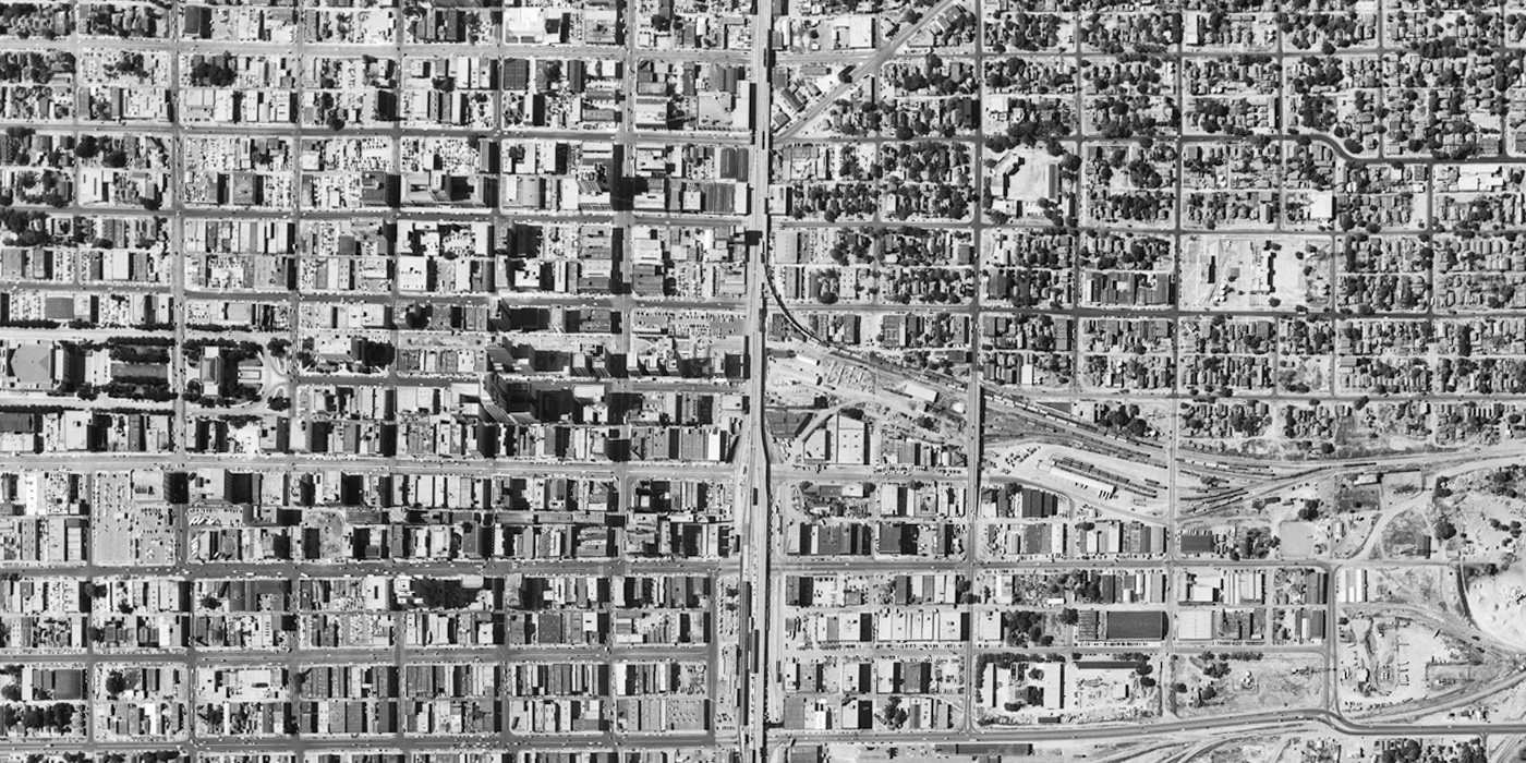
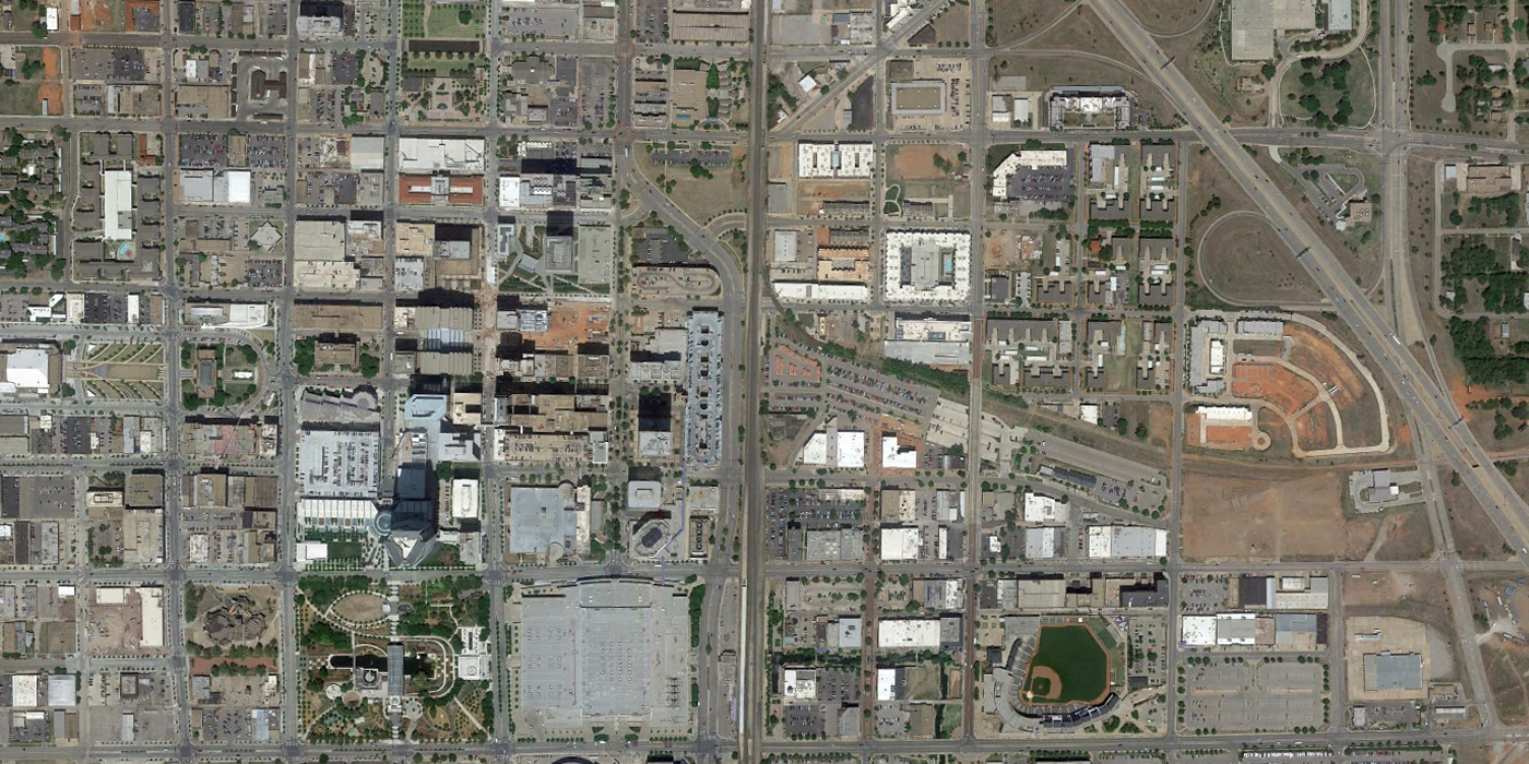
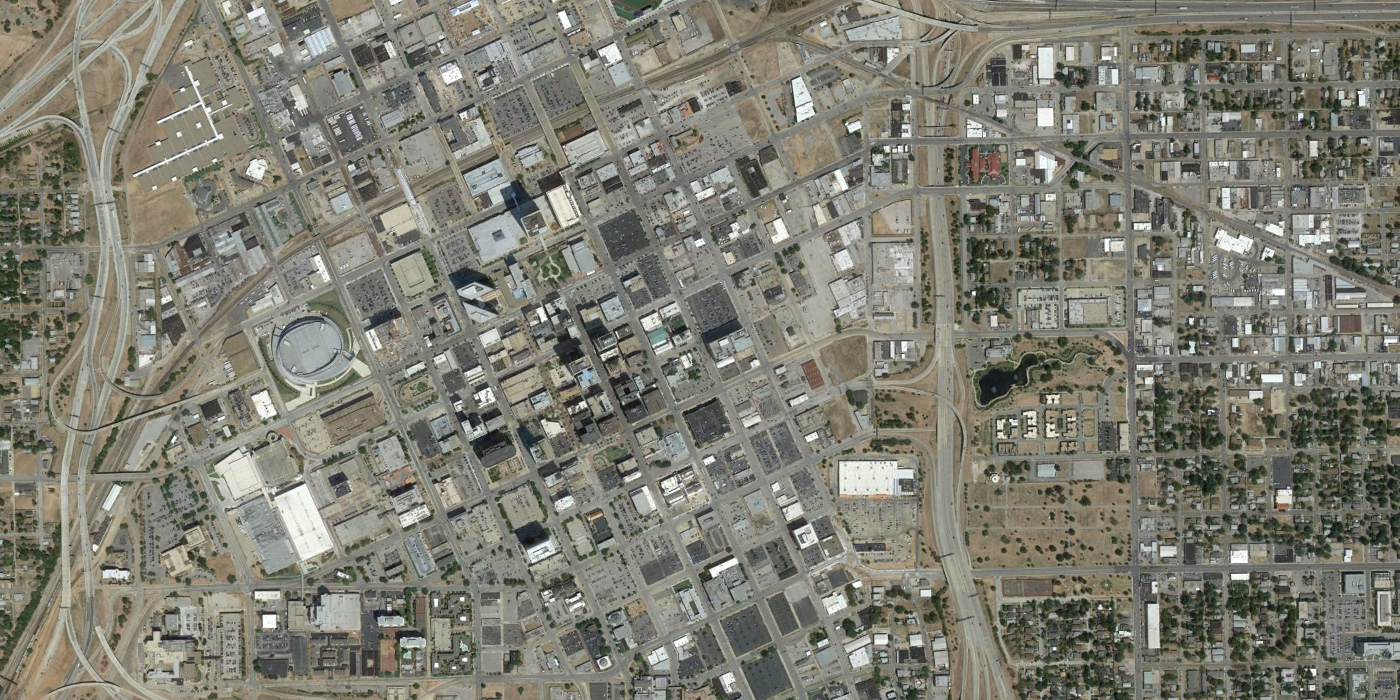
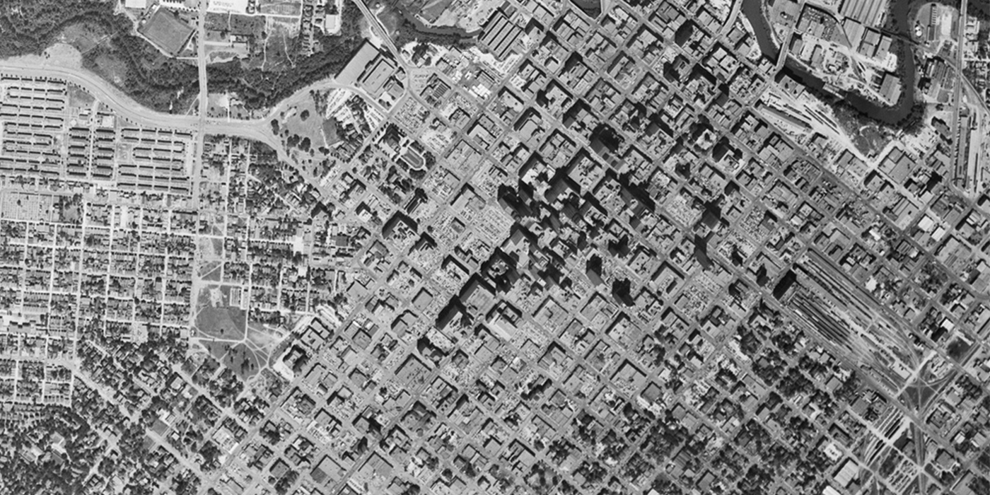
Downtown Oklahoma City, 1954 to 2014
This pair of aerial images highlights the extensive demolition of the urban renewal period in Oklahoma City. Block after block of the orderly 1800s street grid and fine-grained commercial core are replaced with superblocks, large public projects, parking facilities, and freeways. While the consequences of urban renewal were severe, the area is finally coming back with anchors like the Myriad Gardens, Devon Tower, and Chesapeake Arena spurring a new wave of public and private development. The image also includes Deep Deuce, the largest and most important historic Black neighborhood in Oklahoma City. This district and a much greater area to the northeast were extensively targeted by urban renewal for land clearance, freeways, and institutions. Just beyond the frame of this image, the University Medical Center urban renewal project displaced 731 families, 90% families of color, by the 1960s. The area now includes the University of Oklahoma Health Sciences Center.
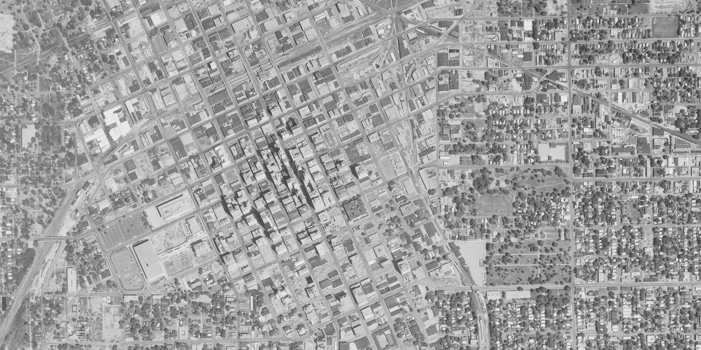
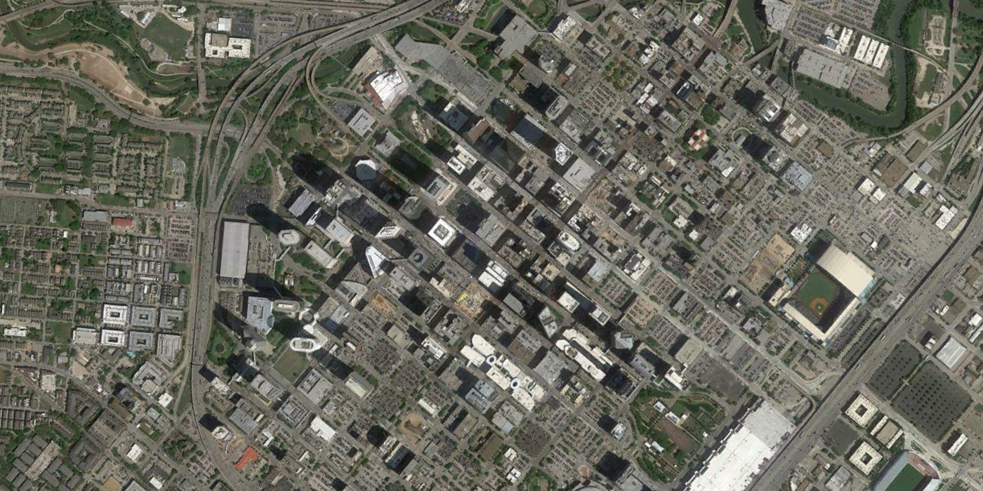
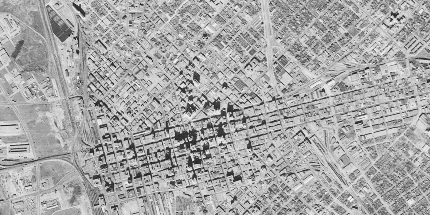
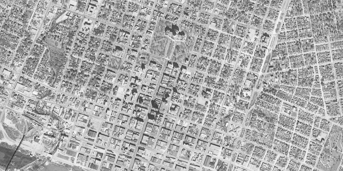
Tulsa, 1967 to 2012
The most significant change in this pair of Tulsa images is the construction of the Inner Dispersal Loop, a highway completely encircling downtown. In the south of the map, you can find the area that won Streetsblog’s Parking Madness in 2013. Tulsa’s Young Professionals helped reimagine the ‘parking crater’ of south downtown with an open streets event in spring 2014. While this map focuses on the downtown area of Tulsa, the area just to the north of the frame is Greenwood, once known as Black Wall Street and the site of a 1921 race massacre. After having some comeback from the 1921 tragedy, the construction of the Inner Dispersal Loop and other land clearance of residential areas hit the area again by the 1960s.
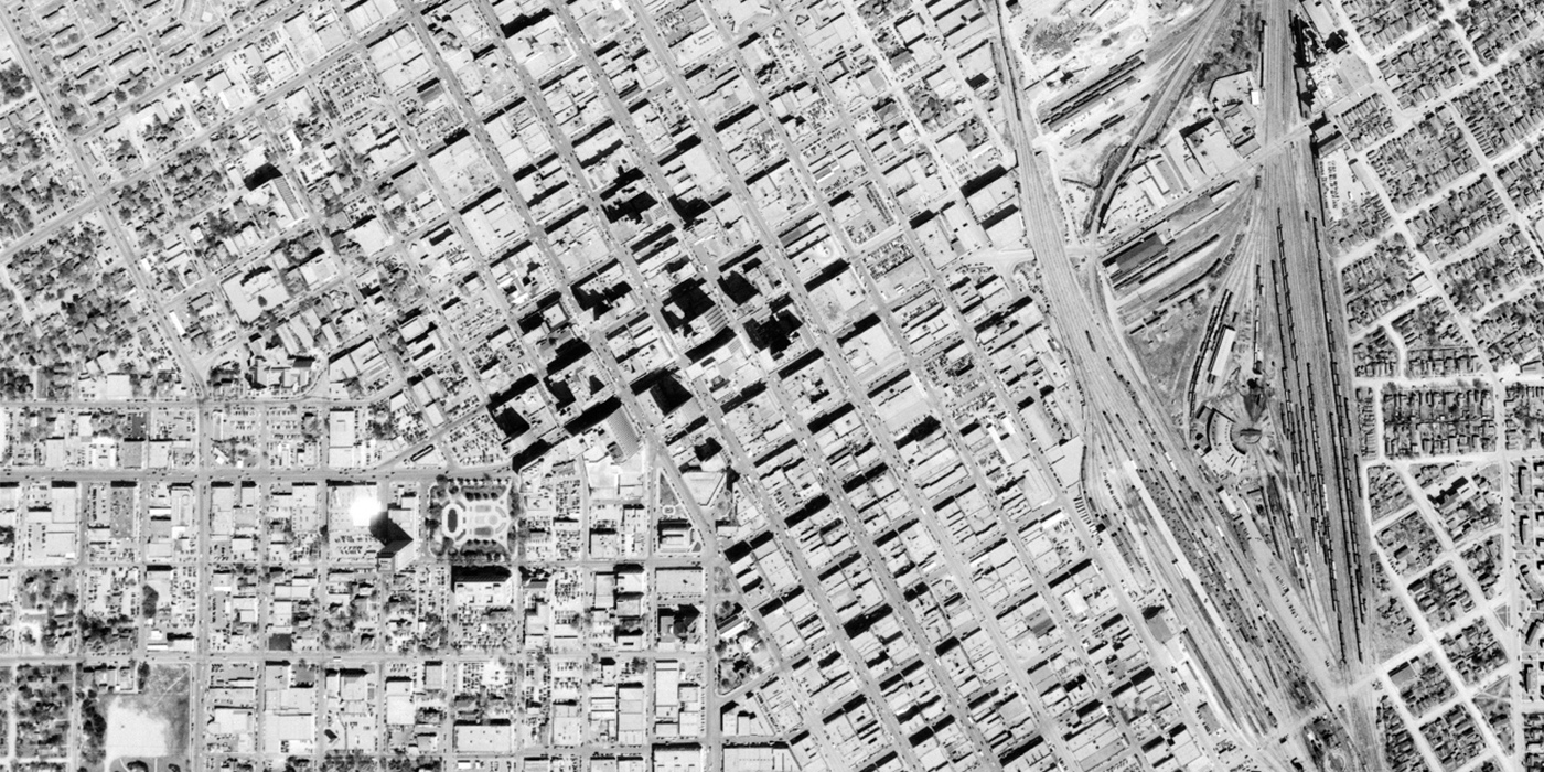
Houston, 1953 to 2014
By the time of the 1953 image, large areas of Houston’s Fourth Ward, also known as Freedmen’s Town and historically the largest settlement for freed slaves in the 1860s, are already occupied by the repetitive forms of urban renewal housing. From the 1930s through the 60s, Freedmen’s Town was continually diminished by urban renewal projects – often resulting in segregated housing that excluded Black people- and the construction of I-45. Comparing the downtown areas of 1950s to 2014, it is clear many blocks are converted to surface parking, making Houston a competitor with Tulsa in 2013’s Parking Madness on Streetsblog. Today, many of the parking lots are starting to disappear and Houston is reactivating its Buffalo Bayou waterway. A CityLab article discusses how race and class played a role in decision-making and advocacy efforts against urban renewal.
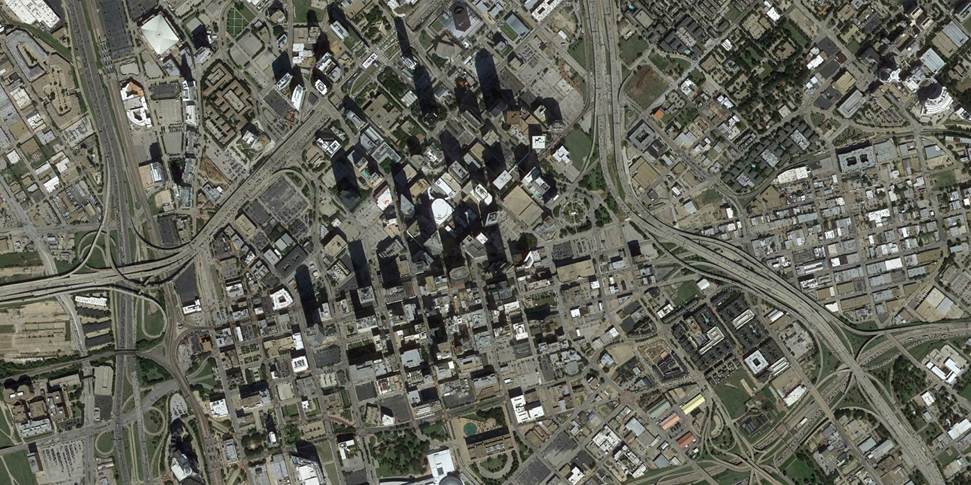
Dallas, 1953 to 2013
Like the other cities in the region, Dallas is transformed by new highways, parking lots, and larger buildings taking the place of smaller-scale blocks. Patrick Kennedy, who writes the Street Smart Blog at D Magazine, has written extensively about this area as part of his work advocating for a teardown of I-345 which cuts between Downtown Dallas and Deep Ellum.
[Update: D Magazine has provided additional comments on this image.]
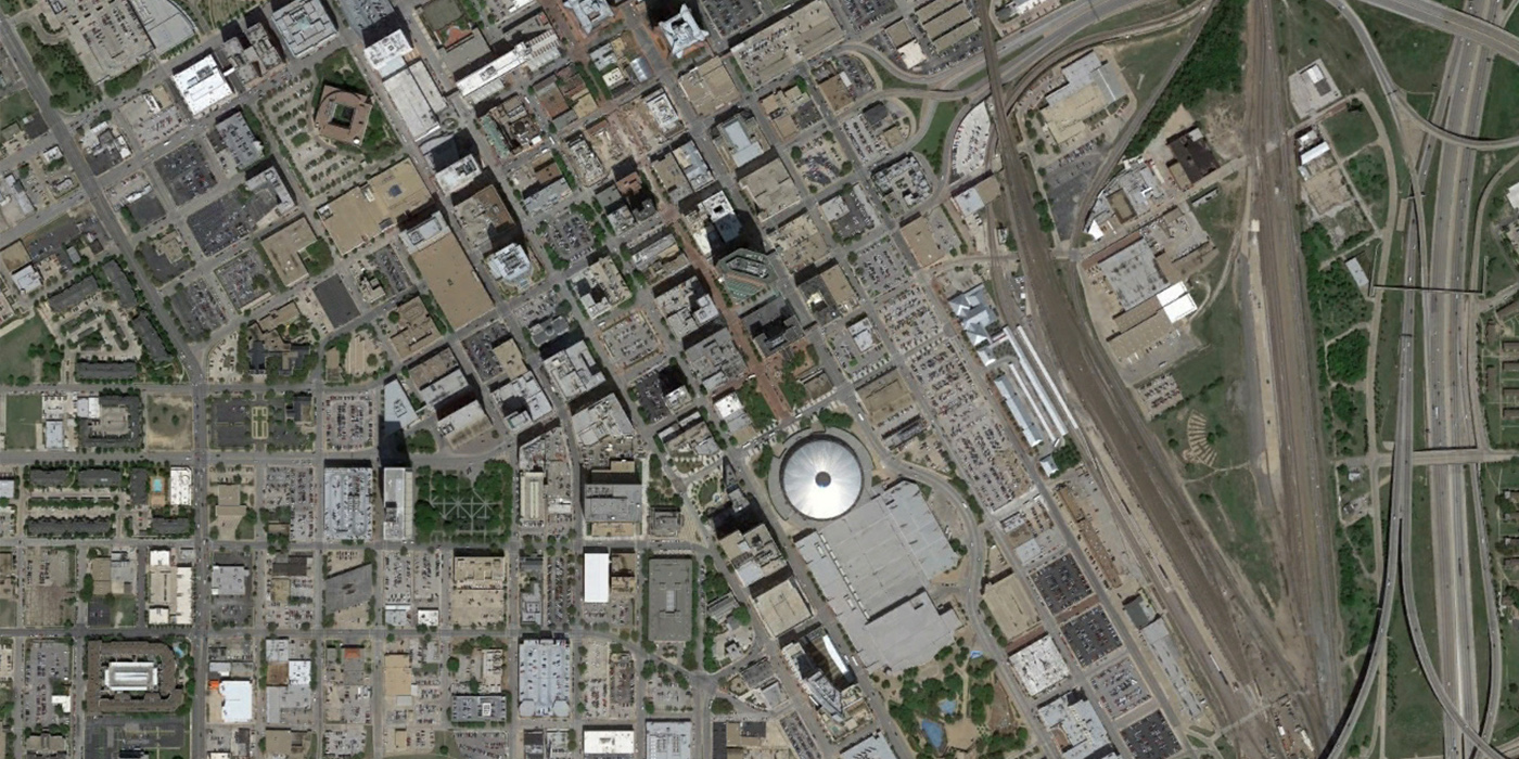
Fort Worth, 1952 to 2013
The Fort Worth Public Library has an excellent archive of material related to the 1950s plan for downtown Fort Worth by Victor Gruen. Fort Worth’s most severe change is the long stretch of commercial blocks replaced by the city’s Convention Center, near the center of the image. While many other cities replaced rail rights-of-way with highways, many of Fort Worth’s railyards remain on the east edge of downtown and highways are built over formerly residential neighborhoods.
Austin, 1953 to 2013
In Austin, it’s easy to spot the rapid growth the city is known for today, as the downtown and state capitol areas expand into formerly residential areas. I-35 slices along the former right-of-way of East Boulevard, which formed the boundary between white and Black Austin. Advocates in Austin are now promoting an effort to reconnect Austin neighborhoods with more street connections across I-35.
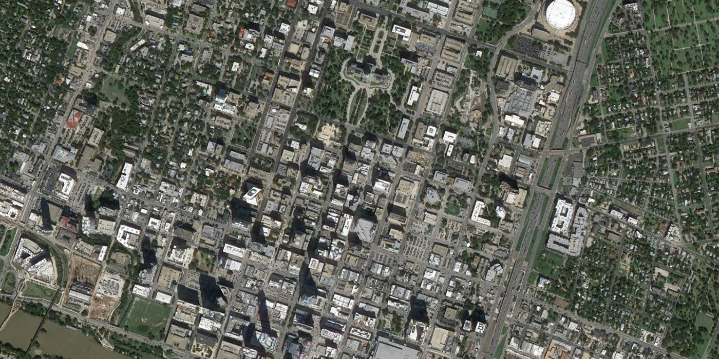
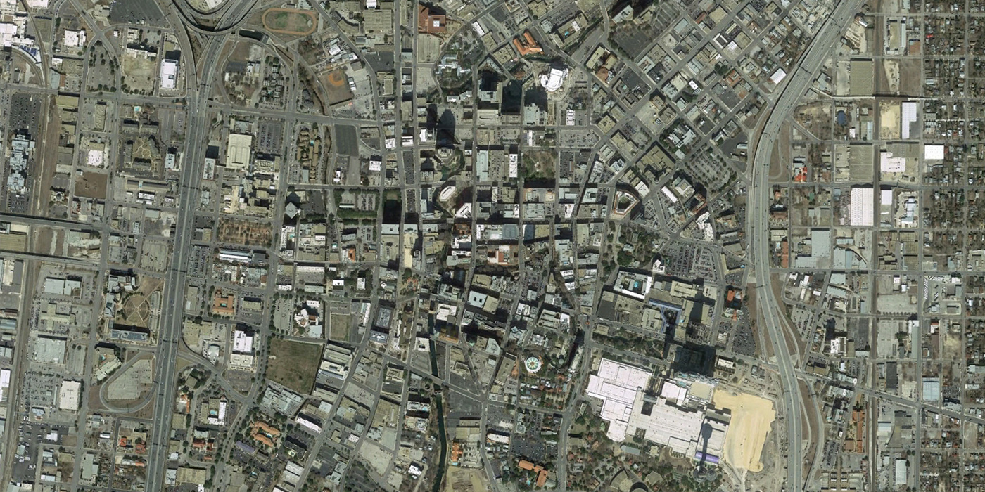
San Antonio, 1953 to 2014
San Antonio is probably the best-preserved urban core in the region, but major new highways and developments are visible at the edges of downtown.
The Oklahoma City picture is misleading. The before shows the CBD and West downtown while after only shows Bricktown/Deep Deuce. Perhaps it didn’t work properly for me. …
Editor’s comment: Please click and drag the slider to reveal the comparisons between before and after photos. They are not a static left/right comparison, but overlaid on top of each other.